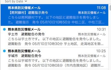
The post I made a few minutes ago about the rain prompted me to check for evacuation notices. The first image you see is from e-mail notifications I have received. The first message says that evacuation orders (not recommendations, orders) were issued for persons in Minami Aso at 10:50 AM. The other two messages say that persons in Uki and Uto have been recommended to evacuate. Persons in areas that are vulnerable to mud slides should pay particular attention to such notices.
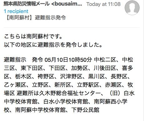
The second image gives the details for the evacuation order issued in Minami Aso.
In the future, I will try to get the prefecture to improve the system to make it more accessible to foreigners (and even if you understand Japanese, the current system has several problems that need to be fixed). In the meantime, the best source of information available through the internet is e-mail. You can sign up for e-mail notifications such as I received here:
https://www.anshin.pref.kumamoto.jp/now.html
Unfortunately, the interface is in Japanese and the messages will come in Japanese. Even if you don't understand Japanese, however, you may be able to make some sense of the information using Google Translate and other such tools.
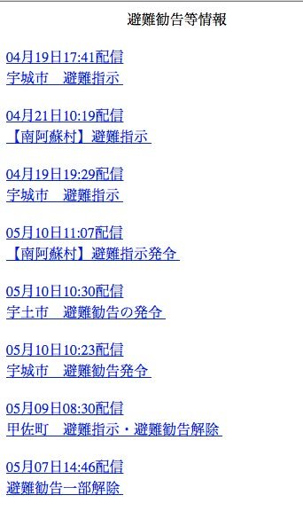
The prefecture also has a page that is an index of the current evacuation notices that have been sent out via e-mail:
https://www.anshin.pref.kumamoto.jp/osirase/index.cgi?type=1001
Unfortunately, the way this page is set up makes it impossible to run it through Google Translate automatically. Moreover, as the third image shows, the order of the information is, well, mechakucha (a mess).
As I think I have written in the past, in addition to current notification methods, I think the prefecture needs to establish a map-based system that visually shows people where current evacuation notices have been issued and to color code them to show the level (order, recommendation, watch, etc).
-- KIrk