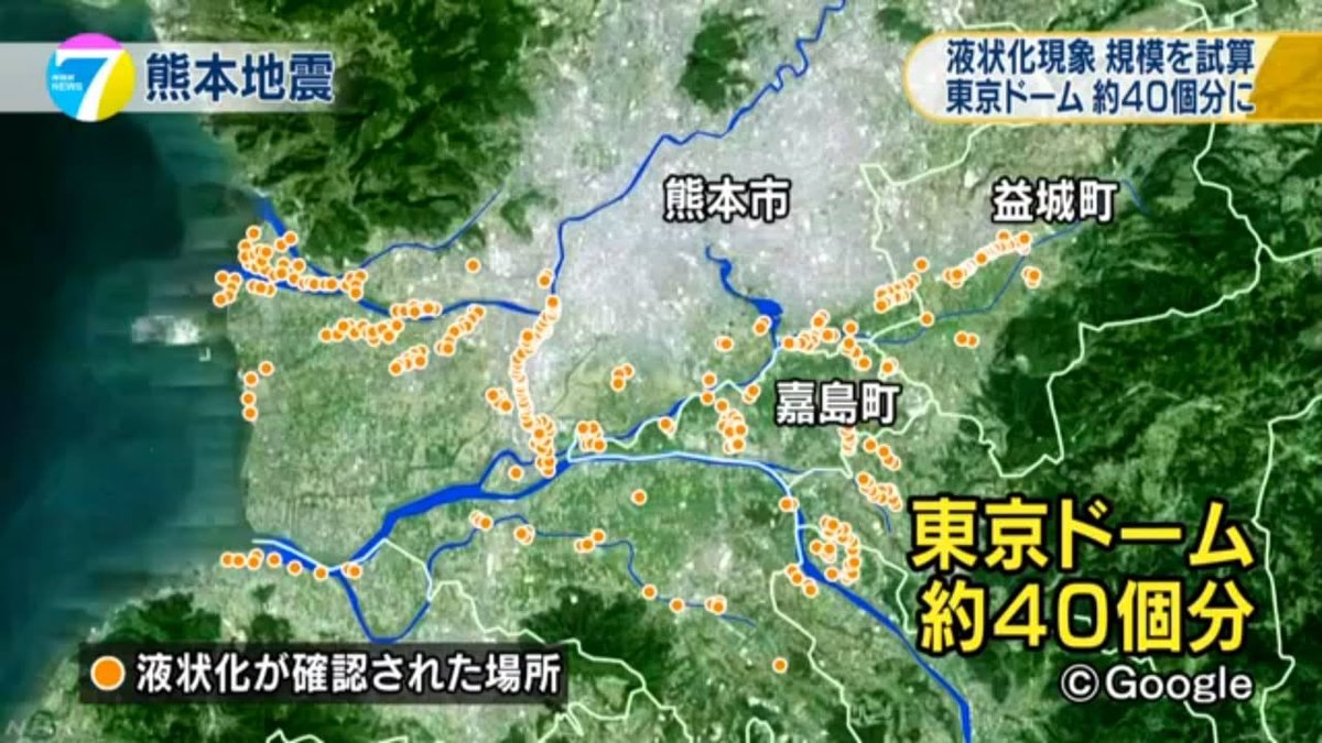
I saw this on NHK's evening news. It's a map that shows areas in Kumamoto where liquefaction (ekijoka; 液状化) occurred. It says that the total affected area is about 40 times the area of Tokyo Dome. If you want to read a Japanese article about this or see the news video go to
http://www3.nhk.or.jp/news/html/20160511/k10010516871000.html
One thing that came out on the news broadcast was the connection with water, both streams and groundwater. One of Kumamoto's greatest strengths -- plentiful groundwater -- seems to work against it when there's a big quake.
The article also says that we need to be aware that liquefaction can cause hollow spots to form underground (especially where sand spurted out during the quake) and that such hollow spots may collapse suddenly long after they were formed.
Also, William posted about liquefaction the other day, so take a look at that if you are interested in the topic:
https://www.facebook.com/Kumamotoi/posts/1033793100027455
-- Kirk