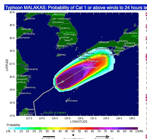
This image may look somewhat less threatening than what I posted earlier, but it's actually an indication or a greater threat -- Category 1 or higher winds. Category 1 winds are between 119 and 153 kph (74-95 mph). Imagine sticking your hand out of a moving car traveling at that kind of speed and that should give you an idea of the power of such winds. The storm itself is now a Category 3 cyclone (178-208 kph or 111-129 mph). It is not on course to hit us directly but it's coming close enough for us to take notice. In the northern hemisphere cyclones (typhoons, hurricanes, etc) spin counterclockwise (see the video I posted here earlier today). This is good for us when a storm comes from the south because the winds must travel over land before they reach us -- they don't come directly from the sea. Land offers more resistance and tends to slow them down. Still, this storm looks like one that deserves to be treated with respect. Even if the winds don't cause mush damage in Kumamoto, there is significant risk of rain-related disasters (flooding, landslides, etc.). Kumamoto is quiet now but the "quiet before the storm" can be deceiving. Take care!
-- Kirk