This image is from a detailed pdf map I found at
http://d2bbxa7r541r3a.cloudfront.net/whatsnew/photo/1475963817.pdf
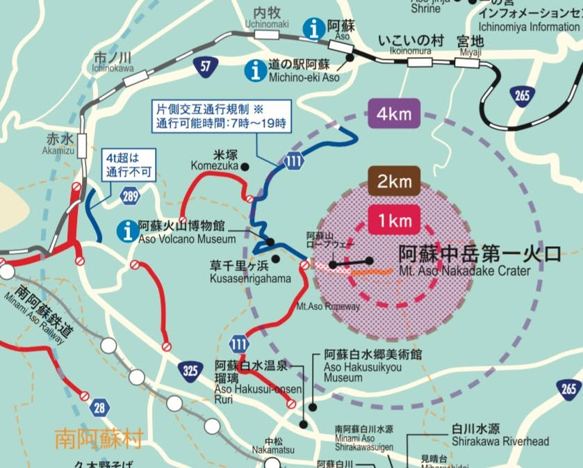
The map is dated "October 8th," immediately after the eruption so I think the information should still be correct. The roads shown in dark blue are "restricted" (daytime hours, alternating single-lane traffic, etc.) but open.
A little more information is available in English at
http://kumanago.jp/whatsnew/?mode=detail&id=366
-- Kirk