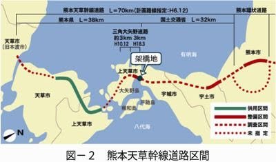
Some questions arose about what will happen with the previous #1 Amakusa bridge. The new bridge is part of an entirely new "southern bypass" that will eventually link Ueki with Hondo (and "eventually" in terms of roadwork means "maybe within our lifetimes"). A map is below with captions: green: complete; solid red: under construction; red dash: planned; red dot: desired but ¯_(ツ)_/¯
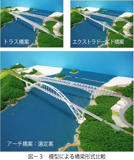
As the new bridge links to a tunnel system through the Uto Peninsula and not surface roads, the old bridge is still necessary for local use, so apparently, both will remain. An illustration below shows the planned configuration.
One reader noted that this might require a name change from "Amakusa Gokyou" to "Amakusa Rokkyou." Interesting thought. - William
http://k-keikaku.or.jp/xc/modules/pc_ktech/index.php?content_id=1942