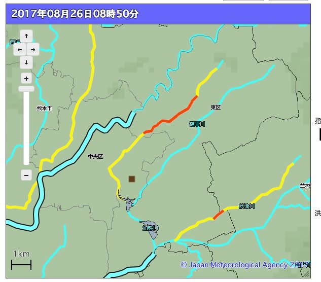
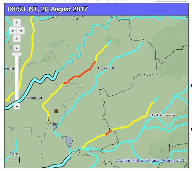
Flood warnings have been issued for parts of Kumamoto. The two images you see below show streams or rivers that are getting closer to flood level. The images are taken from
http://www.jma.go.jp/en/suigaimesh/flood.html
(English)
and
http://www.jma.go.jp/jp/suigaimesh/flood.html
(Japanese)
The JMA seems to have been unable to translate the names of the rivers. That's understandable but it's disappointing that they chose to erase what they could not translate. This is another example of an unfortunate assumption that seems to be all too common -- that presenting information in English means purging it of any and all Japanese information. It fails to recognize that people who access information in English might be able to recognize the orthography of a river in their neighborhood or might want to show the image they have found to a family member or neighbor who does read Japanese.
Another problem with the JMA's otherwise impressive system is that it can be surprisingly difficult, whether you are looking at the Japanese version or the English version, to figure out just where the stream marked in red is. In this case, it's actually not too far from my home. Still, because the JMA map isn't connected to a more detailed map of Kumamoto City, I had to compare it to a Google map in order to try to solve the puzzle of just where the marked stream is located -- and even after doing that I'm not entirely sure.
At any rate, I hope this little discussion proves to be merely academic today and that none of us have to deal with any actual flooding. If you live near a stream or river, however, I think it's a good idea to learn how to take advantage of the information that is available on the web so that you don't need to sit and puzzle over it (like I did today) at a time when you should be taking steps to evacuate.
-- Kirk