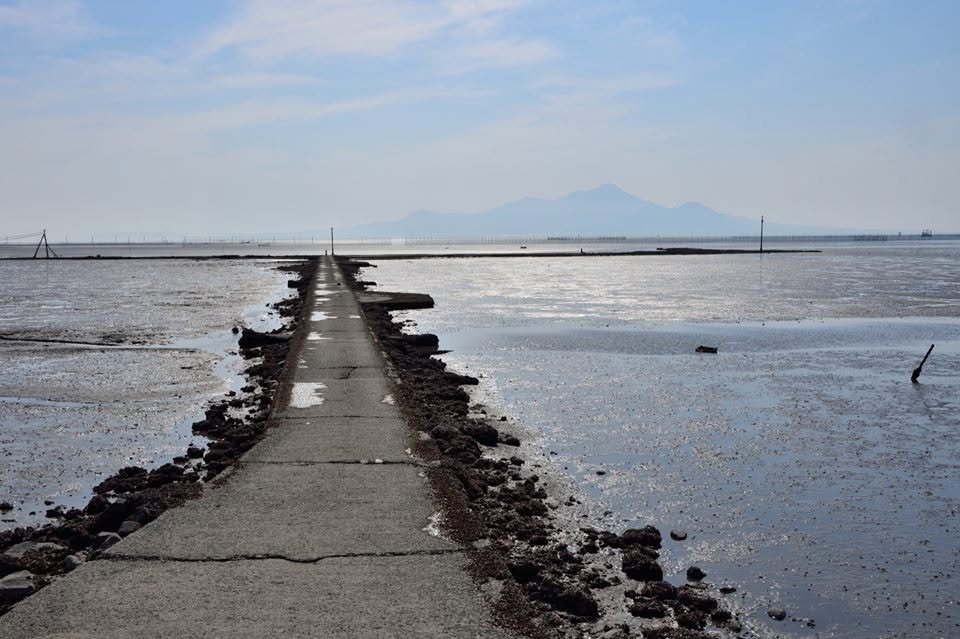
What is known as 有明海 - Ariake Sea - is less than a sea but a large inlet. Due to the tremendous amount of sediment originating from various volcanoes and agriculture, its gradient is extremely shallow, which results in a significant tidal distance, often a kilometer or more depending on the location. Feeding 130 million people also requires that the sea be a gigantic farm, with nori (laver seaweed) and asari clams the most cultivated. A problem is how to access the cultivatable areas, which resourceful fishermen have solved by creating long roads which are submerged at high tide but usable during low (timing is key here or you'll find your car submerged).
Our friend Yoshiko Toyama captured a wonderful photograph of such a road with Nagasaki's Fugen Mountain (普賢岳) in the background. She noted in her post that it has been 27 years since Fugen last erupted, an event I remember as I'd just arrived in Kumamoto at the time (lots of ash every day). Trivia point: a tsunami which resulted in one of the greatest tsunami-related death tolls occurred here in the 17th century when part of the mountain cascaded into the sea, resulting in a "bathtub effect," in which the wave washed over Kumamoto and then bounced back to the Shimabara peninsula, pretty much killing all coastal residents on both sides. (Okay, not so trivial for the victims, but time tends to lighten tragedy.)
Thank you, Yoshiko-san, for this wonderful photo. - William