This will be my last post about the rain for now.
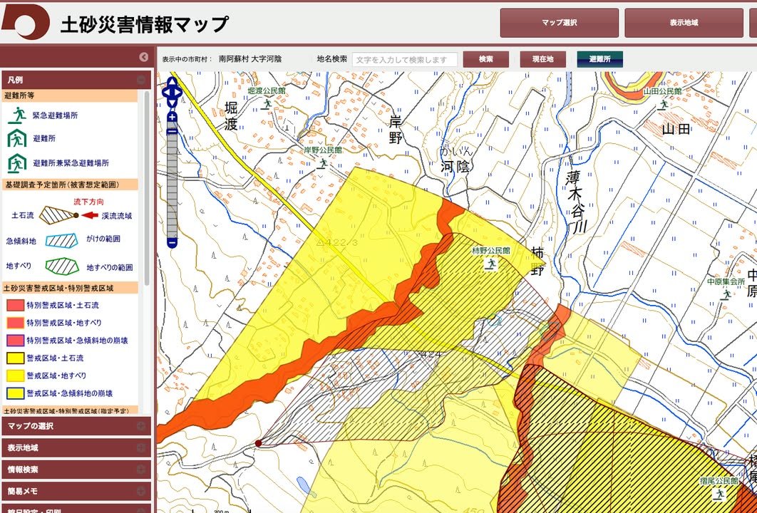
Earlier today, Atsuko shared a web site that provides information about evacuation sites and about areas that are vulnerable to landslides. Thanks Atsuko!
Even if we don't experience extreme rain in the next 24 hours, we've had enough already to significantly heighten the danger of landslides. The website is only in Japanese and you can't even use Google translate with it. Still yellow is risky and red is very risky. So, if you can figure out where you are, you can see if there are slopes that are deemed to be at risk for landslides, etc. nearby. Also, the green sites are evacuation sites.
I think there are probably relatively few non-Japanese readers of this page that live at the foot of a dangerous slope or on the banks of a raging river. I think it's probably more likely that one or two of our readers might decide to drive along a path that could put them in danger. People have died in Kumamoto when their cars have been hit by landslides. So, if you're not sure exactly what areas on a route you are considering are risky, you might want to delay your trip until the weather gets better and the slopes have died out a bit.
-- Kirk