Kirk again. I just posted about checking out your area to see how prone to flooding it is:
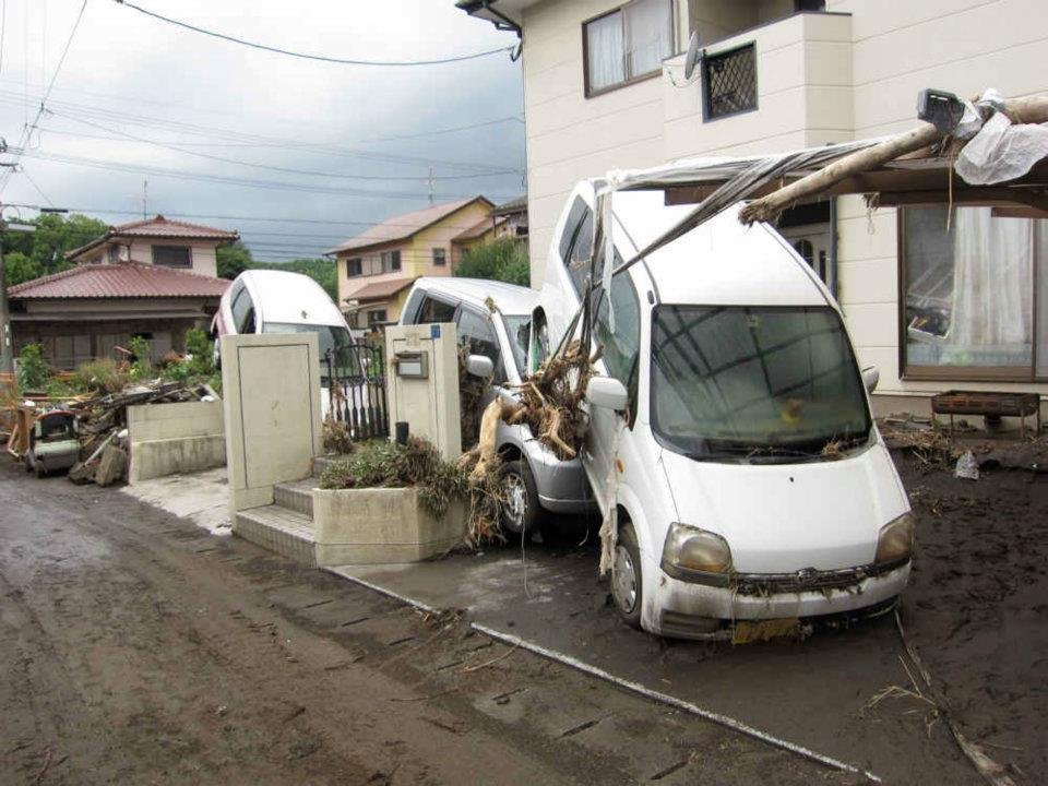
In that post, I explained that the peak flooding levels shown on the map are "once in 1000 years." But, in my experience, flooding in Kumamoto is something that happens every few decades or so. The picture of the upturned car you see is one I took just 10 years ago when the Shirakawa flooded and much of the Tatsuda-Jinai (Tatsuta-Jinai?) area was hit.
https://www.facebook.com/Kumamotoi/photos/a.357665327640239/357665407640231
At that time, the problem was not too many false alarm evacuation notices but a failure on the part of the city to issue a notice early enough:
https://www.facebook.com/Kumamotoi/photos/a.359561604117278/359561624117276/
Fortunately, no one died but it was necessary to evacuate some stranded people by helicopter:
https://www.facebook.com/Kumamotoi/photos/a.359561604117278/359572174116221/
So, even though warnings often seem to be "much ado about nothing" sometimes bad things really do happen. It's best to try to be aware of your circumstances and prepare -- just in case.