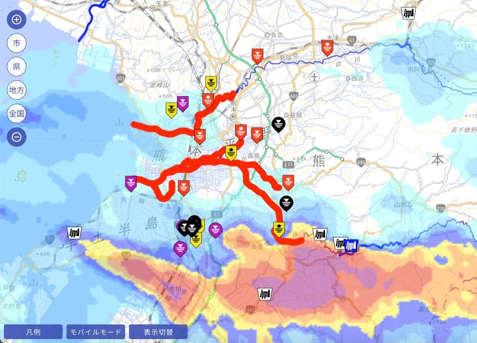
Kirk again. My classes have been cancelled for today due to the rain so I have a bit more time to provide updates. If you are anywhere near a river (or if you are just curious) you should know about the following website:
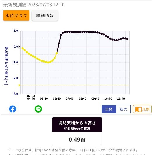
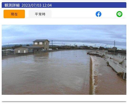
As an illustration, I've added screenshots of the Shinkawa Bridge, which is on the Iwatogawa, in Mashiki-machi. The data indicates that the water level is higher (!) than the levee. You can see what that looks like in the live photo. Even if you don't read Japanese, this map should help you learn about the current status of the riiver(s) near you.
Oh, one last bit of advice: Please confine your curiosity about what a river looks like at the moment to what you can see via a remote camera. I've heard quite a few media reports about people who went to take a look at a river during a rainstorm and didn't live to tell about it.