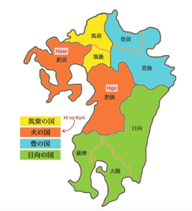
Hi! Kirk here with a repost and addendum to a post I made a while ago about "Hi no kuni" ("land of fire" vs. "land of fat"). I'm afraid I had forgotten since posting about how learning a bit about these old "countries" (kuni) in Kyushu (Higo vs. Kumamoto, etc.) also helps one understand how Kyushu (literally "nine states"; 九州) got its name. If you count the number of prefectures that make up Kyushu today it's not nine but seven. That's because two "countries" to our south (Satsuma and Okuma) were combined to make what is now Kagoshima, "Hizen" was divided into Nagasaki and Saga, and the three "countries" of Chikuzen, Chikugo and Buzen (its western half) to our north were combined to make Fukuoka, thus resulting in a total of seven prefectures. Only Higo (Kumamoto) and Hyuga (Miyazaki) survived the transition from "countries" (kuni or han) to "prefectures" (ken) with little or no change in boundaries.
Here's a review of the names for those who are interested:
Higo and Hizen are shown on the map in red.
Chikuzen and Chikugo are in yellow.
Buzen and Bungo are in blue.
Hyuga, Satsuma, and Okuma are in green.
When pairs of country names end in either "zen" or "go" (lit. "before" and "after"), the one ending in "zen" is considered to be closer to Edo (Tokyo).