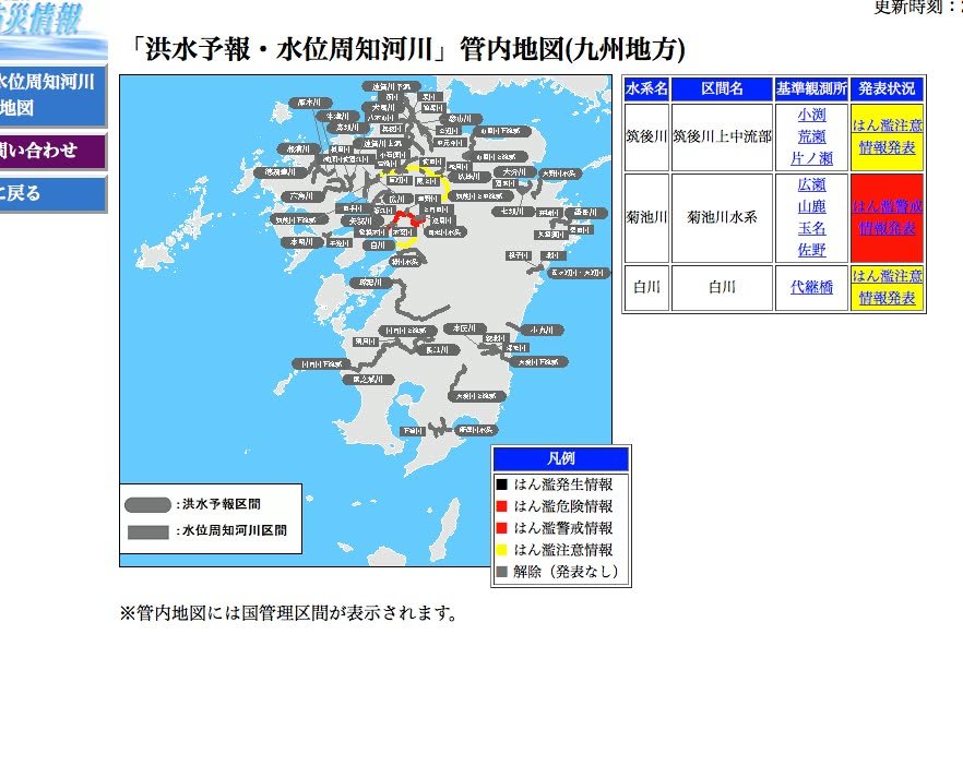
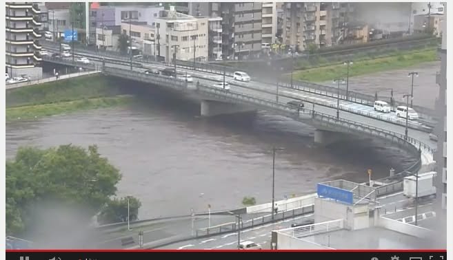
The first image is from a site that indicates which rivers are in danger of flooding. Currently, the Kikuchigawa is at the hanran keikai joho (flood warning information) level, the third highest. Tthe highest is confirmation of an actual flood and the second highest is the "danger" level, indicating that at flood is imminent. The water level in the Shirakawa, which runs through the heart of Kumamoto City, is also elevated. The photo is a screen shot of a live camera of the river. There does not seem to be much danger of flooding but the level is indeed higher than normal.
To see the site with the flood warnings go to
http://www.river.go.jp/nrpc0502gDisp.do?areaCode=89
To see the live camera go to
https://www.youtube.com/watch?v=4t0Mz9V2xZQ&feature=youtu.be