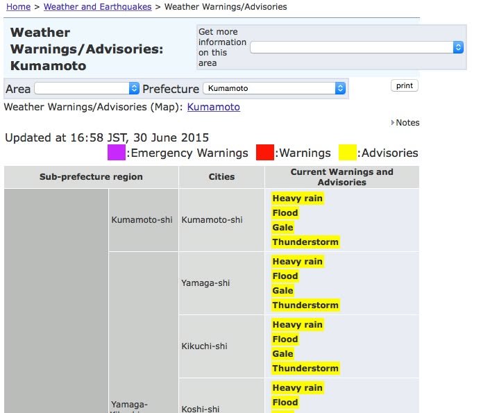
There are warnings about heavy rains that are likely to be at their strongest early tomorrow (Tuesday) morning. The image you see is from
http://www.jma.go.jp/en/warn/349_table.html
To see animated radar images of the Kumamoto area, go to
http://kumamoto.wni.co.jp/radar/rnkg/info_frame.html
If there are calls for evacuations, they should be listed at
http://www.anshin.pref.kumamoto.jp/osirase/index.cgi?type=1001
Unfortunately, however, this information is only presented in Japanese (and in a less than ideal format even in Japanese) so you have to make quite an effort to figure out what is happening.
If you live near a river that might flood or a steep slope where a landslide might occur, it's a good idea to make sure you have people to provide you with any help you might need.