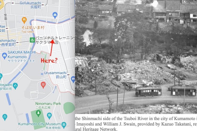
Kirk here with a folllow-up to William's post about the bombing of Kumamoto in WWII. The photo in it piqued by interest so I tried to figure out where it was taken and from what angle. The Shinmachi place name, the curving tram line (which I assume followed the same route that is does today), and the Tsuboi River (visible beyond the curving tram tracks) made it relatively easy to make an educated guess.
I've zoomed in to make the location clearer. Most of the smoke from the bombing is beyond the Tsuboi River and so not visible in my zoomed in version. The original is here: https://mainichi.jp/english/graphs/20200709/hpe/00m/0na/002000g/5 )
One thing about this that interests me is that Shinmachi has a lot of old buildings and so I was under the impression that it wasn't hit as hard as other parts.
When I look at photos of the devastation of war they seem rather otherworldly to me. But, what I'm seeing on the news from Ukraine is reminding me that people were living peacefully in those devasted structures when they were struck. Pray for peace.
William's orginal post is here:
https://www.facebook.com/Kumamotoi/posts/6975113239228715