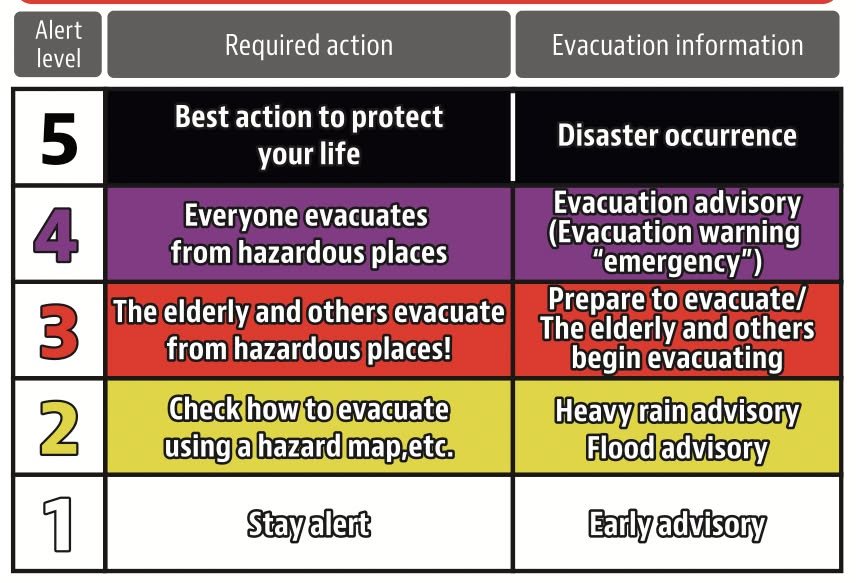
Kirk with some information about how to interpret disaster information issued in Kumamoto.
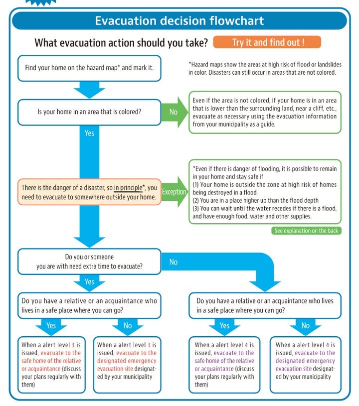
In short: Evacuation advisories are already being issued for parts of Kumamoto Prefecture, including Kumamoto City. However, even if you are in an area for which evacuations are called, you may not actually need to evacuate so check the flow chart.
The screenshots I'm adding to this post are from a pdf that can be found at the following address:
https://www.bousai.go.jp/oukyu/hinankankoku/h30_hinankankoku_guideline/pdf/campaign_en.pdf
If you'd like a Japanese copy you can find it here:
https://www.bousai.go.jp/oukyu/hinankankoku/h30_hinankankoku_guideline/pdf/campaign.pdf
Kumamoto City is now at level three. You can find information about current evacuation warning levels here:
https://crisis.yahoo.co.jp/evacuation/43/43100/
This is in Japanese but it is possible to view it in English with Google Translate. The color codings (e.g. level 3, red, etc.) is the same as the screenshots I've provided.
But, even though the evacuations have been called for in Kumamoto City, that may not apply to you. It depends on whether your specific housing situation and/or health situation makes you vulnerable to flooding, landslides, power failures.
Kumamoto Prefecture has a disaster page with a map and translation options:
https://portal.bousai.pref.kumamoto.jp/
I looks like an improvement over the previous site but it's still pretty awful. One problem is that the evacuation level for Kumamoto is not yet reflected on it, even though the Yahoo's commercial site already has the information. Secondly, I found the implementation of the Google translate service (official added by the prefecture) to be quite buggy.
Why is disaster information in Japan such a disaster?