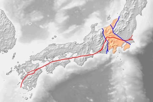
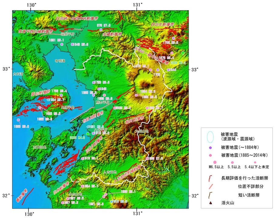
William with a quick note for seismologicophiles: A fault system bisects Japan vertically, running from Ibaraki down to the coast off Kagoshima called the Japan Median Tectonic Line https://en.wikipedia.org/wiki/Japan_Median_Tectonic_Line. It's composed of a smattering of right-lateral strike-slip faults moving at a rate of about 5–10 mm/yr. It angles north-east/southwest from Beppu, under the volcano, and to the south of Kumamoto City, where it splits into two faults: the Futagawa, which runs along the north of the Uto Peninsula, and the Hinagu, which runs through Yatsushiro. This evening's quake was likely a rupture of the Hinagu fault.
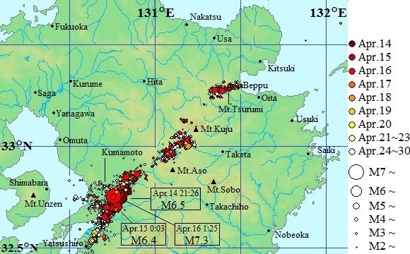
Regarding the 2016 quakes https://en.wikipedia.org/wiki/2016_Kumamoto_earthquakes, seismologists wrote (according to Wikipedia) that the foreshock was due to activity of the Hinagu fault zone, while the mainshock was the subsequent rupture of the Futagawa fault zone, showing how the two can work in tandem.
I was unaware of this in 2016 and immediately posted after the first quake that further activity was unlikely. I was wrong, not being aware of the twin faults. The map below shows two foreshocks and the mainshock of M6.5 on April 14, M6.4 on 4/15, and M7.3 on 4/16.
Whether this evening's quake was it or rather a foreshock we'll find out, but I am sleeping with my clothes on for the next few days.