Archive of the Kumamoto International Facebook group, 2011–present.

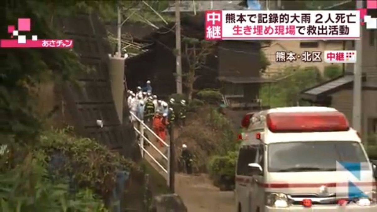
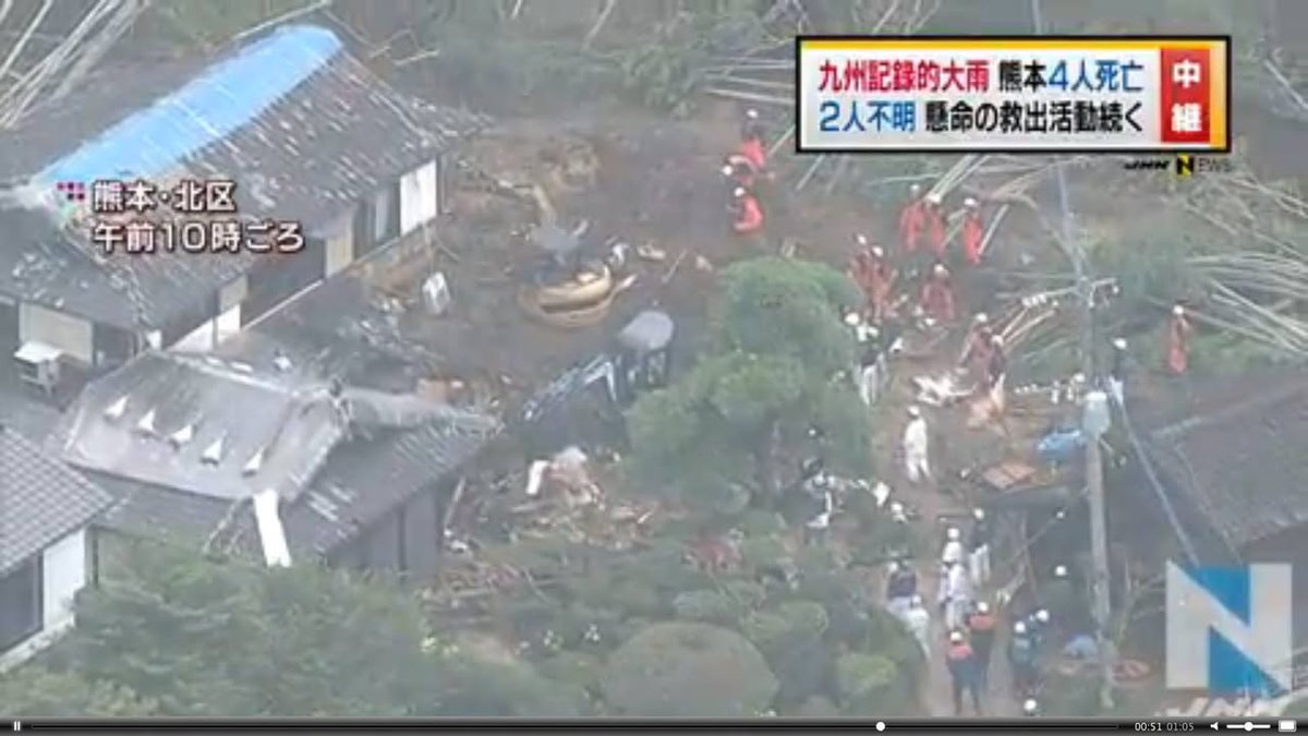
This image from Kita-ku (the northern ward) of Kumamoto City shows a house the a blue tarp on the roof (the result of quake damage) that has been further damaged by a landslide resulting from last night's rain.
-- Kirk
http://news.tbs.co.jp/newseye/tbs_newseye2802637.html
2016-06-21 13:37 JST

The latest information I've seen in Japanese is that 4 have been confirmed dead and two are missing in Kumamoto as a result of last night's downpour:
Japanese source:
http://news.tbs.co.jp/newseye/tbs_newseye2802919.html
-- Kirk
http://www.japantimes.co.jp/news/2016/06/21/national/kumamoto-area-downpours-leave-two-dead-three-missing-trigger-evacuation-advisories/

Kumamoto-area downpours leave two dead, three missing, trigger evacuation advisories | The Japan...
Two people died and three were missing in Kumamoto Prefecture Tuesday morning as torrential rain since Monday night caused mudslides and flooded irrigation channels.

2016-06-21 13:27 JST

Below is a photo of damage caused when a large tree behind Kato Shrine at Kumamoto Castle was uprooted and toppled down the already half-destroyed wall. A quote from the article that the wise will take to heart: "Do not enter areas that have been declared off limits."
http://kumanichi.com/news/local/main/20160621001.xhtml

熊本城、災難続く 石垣崩落、雨で拡大-熊本のニュース│ くまにちコム
熊本日日新聞社が取材した熊本のニュース。新聞紙面に掲載前の記事もお伝えします。

2016-06-21 10:51 JST

The following link takes you to an article in English. I found more details, however, in a video on that page (the screenshots are taken from that video).
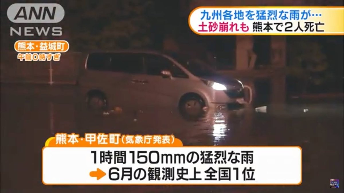
1) 150mm (6 inches) per hour of rain in Kosa, a record
2) One elderly man in Kosa died when he went to look at river
3) In Kami Amakusa, a mudslide killed a man in his 90s
4) Landslides in Uto have trapped two people in their homes
-- Kirk
http://newsonjapan.com/html/newsdesk/article/116650.php

2016-06-21 09:18 JST

This TBS report (video available) says that a landslide has trapped an elderly couple in their home in Tsunouramachi (Kita Ward, Kumamoto City). The report says that two people died in last night's heavy rains but I don't have the details at the moment.
-- Kirk
http://news.tbs.co.jp/newseye/tbs_newseye2802637.html

2016-06-21 08:48 JST

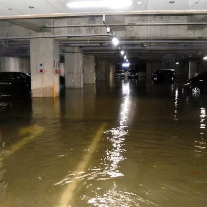
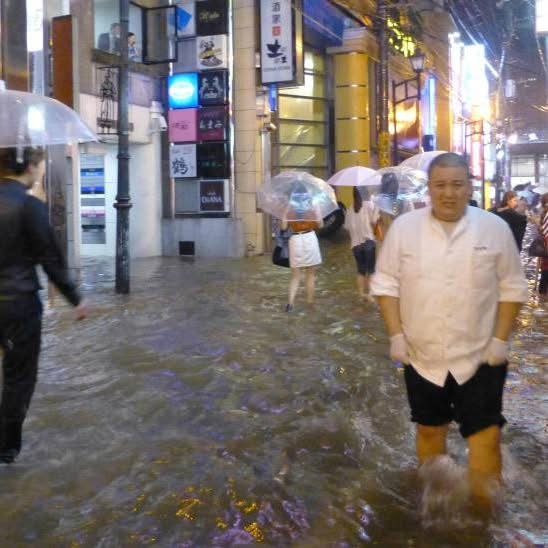
The intense rain last night flooded the parking lot in the Kencho (prefectural government office building). The caption says the photo was taken a little after 11 PM on the 20th.
The article also says that Kosa-machi got a record-breaking 150 millimeters (almost 6 inches) of rain in just an hour last night.
http://www.asahi.com/articles/photo/AS20160621000059.html

熊本で豪雨、1時間に150ミリ 土砂崩れで民家埋まる:朝日新聞デジタル

2016-06-21 08:43 JST

Kumamoto panel releases report on quake-recovery proposals | The Japan Times
A panel set up by the Kumamoto Prefectural Government says the lessons learned from April's powerful earthquakes need to be preserved and passed on to bett

2016-06-21 08:37 JST

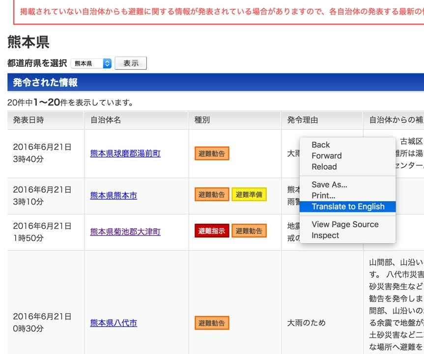
In regard to the issue of how to access evacuation information, I got an extremely useful tip from Nicholas Choquette. Nicholas pointed out that if we use the Chrome browser (put out by Google), we can right click on almost any Japanese page and then see a translated version. When the Japanese seems really strange, we can easily access the Japanese on the original page to try to figure out what it means.
http://crisis.yahoo.co.jp/evacuation/43/
Thanks Nicholas!!
The Chrome browser also makes the page put out by the prefecture accessible:
https://www.anshin.pref.kumamoto.jp/osirase/index.cgi?type=1001
However, as I wrote before, I think the Yahoo page is much better.
By the way, the screenshots are current. Though Kumamoto City is now quite calm, calls for evacuation are still in effect for some parts of Kumamoto.
-- Kirk

2016-06-21 07:27 JST

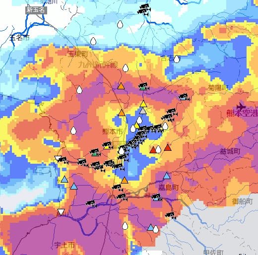
This map is hard to make out (particularly if you don't read Japanese) but it shows the current situation in the Kumamoto City area. Many of the camera marks on the map are on the Shirakawa River, so if you know where the Shirakawa is, that may help you make sense of the map. The red triangles indicate waterways that have reached the flood level. (They may not have flooded yet, but they are very close to doing so.) One of them is the little waterway that runs by the Nishikigaoka Park in Kengun -- a favorite jogging spot of mine. As far as I can tell, major rivers such as the Shirakawa are still OK but smaller waterways are having trouble handling the sudden surge. Be careful around such places.
http://www.river.go.jp/kawabou/ipGaikyoMap.do?areaCd=89&prefCd=4301&townCd=4301201&gamenId=01-0701&fldCtlParty=no
-- Kirk

2016-06-20 23:22 JST

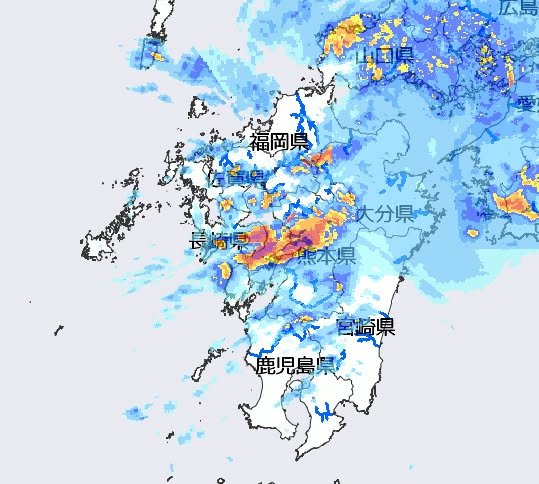
If you are in Kumamoto now, you don't need radar to tell you that the rain is intense. Nonetheless, here's that confirmation just the same.
-- Kirk
http://www.river.go.jp/kawabou/ipRadar.do?areaCd=89&prefCd=&townCd=&gamenId=01-0706&fldCtlParty=no

2016-06-20 23:02 JST

A reminder about the livecams maintained on the main bridges along Shirakawa through Kumamoto in case you are curious about the river level but don't feel like walking out there to check for youself. (Trust me: you don't.) http://www.qsr.mlit.go.jp/kumamoto/bousai/kasen_live/kasen_live01.html

2016-06-20 22:20 JST

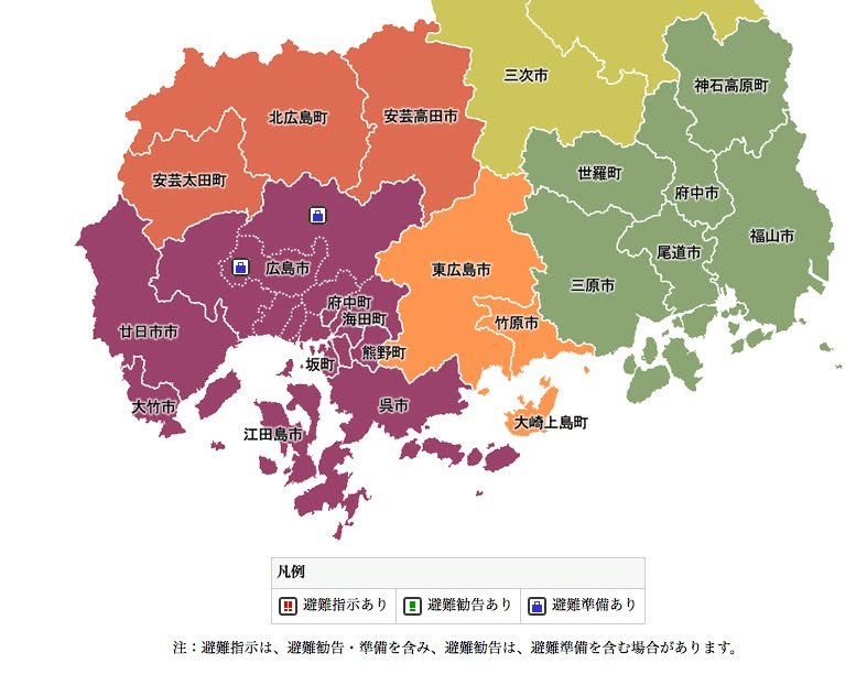
Kumamoto should do what Hiroshima has done: Put evacuation notices on an easy to understand map. Right now, Hiroshima only has a couple of places where people are being told to get ready to evacuate (the blue suitcases). If there were evacuation recommendations (a green ! mark) or evacuation orders (a red !!! mark) they would appear on the map in the same way. Even if one couldn't read Japanese, one could easily learn to check for any of the three marks in your area and then take appropriate action.
http://www.bousai.pref.hiroshima.jp/hdis/sizi/
-- This rant has been brought to you by Kirk

2016-06-20 21:44 JST

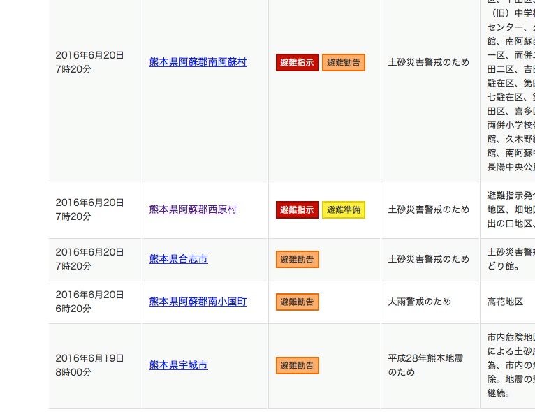
I'm trying to post information about various evacuation orders and recommendations but Kumamoto Prefecture makes this sort of information very difficult to confirm on the web. The page they provide is
https://www.anshin.pref.kumamoto.jp/osirase/index.cgi?type=1001
but even if you read Japanese the information is hard to interpret and clearly incomplete. Yahoo is much better.
http://crisis.yahoo.co.jp/evacuation/43/
One problem with this Yahoo page, however, is that you can't run it through an automatic translator, like Google translate. So, if you don't read Japanese, you need to get the help of someone who does.
At any rate, a lot of evacuation notices have been issued. I wish I could give you better information but I don't have time to try to translate everything. All I can say now is that, if you are unsure about the situation in your area, you should probably ask someone nearby for advice.
-- Kirk

2016-06-20 21:27 JST

As of 5:30 this evening, the people of Mifune are being told to prepare for possible evacuation.
06月20日18:32配信
御船町 避難準備
6月20日17時30分町内全域(避難指示・避難勧告地域を除く)に避難準備情報を発令しました。各地域の避難所は、御船地区(御船中体育館)●滝尾地区(カルチャーセンター)●水越地区(旧水越小体育館)●七滝地区(七滝分館)●上野地区(上野保育園)●田代東部地区(田代東部公民館)●田代西部地区(北田代公民館)●木倉地区(木倉小体育館)●高木地区(御船小体育館)●小坂地区(小坂小体育館)です。
https://www.anshin.pref.kumamoto.jp/osirase/view.cgi?log_id=572

2016-06-20 21:11 JST

An evacuation notice (hinan kankoku -- not an order but a recommendation) has been issued for Kikuchi City. The Japanese text says it was issued at about 4:30 PM but then sent out (on the internet?) at 6:16 PM. The Japanese text also provides the names of evacuation sites that are available.
06月20日18:16配信
避難勧告発令
こちらは菊池市です。
以下の地区に避難勧告を発令しました。
避難勧告 発令 06月20日16時30分 土砂災害(特別)警戒区域等 避難所は菊池市福祉会館、七城公民館、旭志公民館、泗水公民館、水源交流館、やまびこ体育館、旧龍門小学校、旧迫水小学校体育館
https://www.anshin.pref.kumamoto.jp/osirase/view.cgi?log_id=571

2016-06-20 21:05 JST

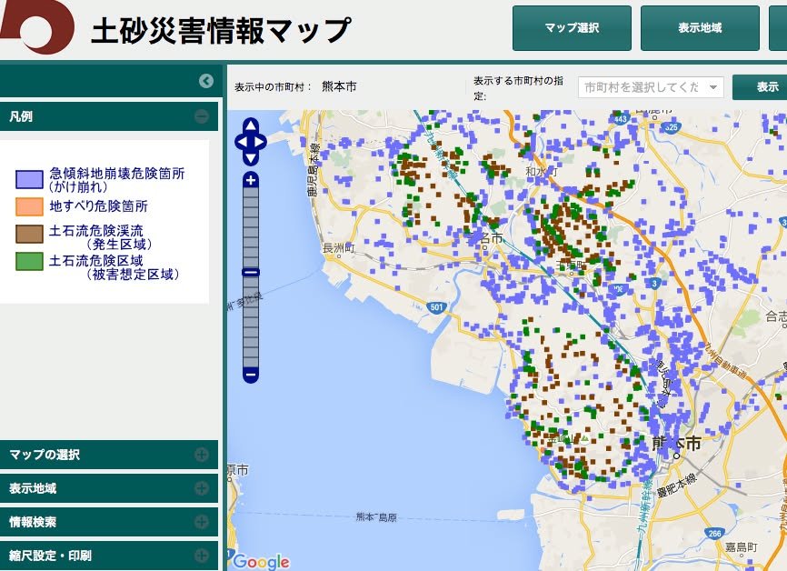
I just came across this map, which provides detailed visual information about areas that are at risk for landslides. This information doesn't change; it merely shows the locations of areas that are deemed to be at risk because of their physical characteristics. This is something that you might refer to if you are considering driving at night, during heavy rain, and are wondering if the area you are driving through might be risky.
http://sabo.kiken.pref.kumamoto.jp/website/sabo/kasho/
There are four colors:
1) Blue: Areas with steep inclines (nearly cliffs) that are susceptible to landslides (gakekuzure);
2) Orange: Areas that are not as steep as the blue areas but, nonetheless, are susceptible to mudslides and landslides (jisuberi);
3) Brown: Gorges along which a mudslide might flow (dosekiryu);
4) Green: Areas into which a mudslide flow (from a brown area) might wind up (dosekiryu higai sotei)
When in doubt, err on the side of safety!
-- Kirk

2016-06-20 20:56 JST

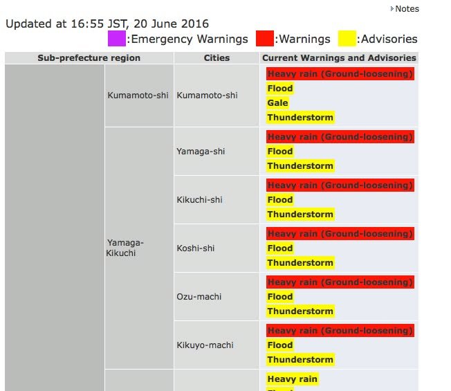
As I pointed out yesterday, "ground loosening" isn't what farmers do to get their fields ready for planting -- it means that there is an elevated risk of landslides. Note too that flooding is an additional possibility. To see the details for your area, click on the following link:
http://www.jma.go.jp/en/warn/349_table.html
Kirk

2016-06-20 20:22 JST

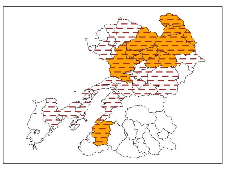
This map, which was issued at 3 PM today, shows areas that are thought to be vulnerable to landslides (shown in orange). The horizontal red lines indicate areas affect by the earthquakes. The pdf from which this screenshot was taken can be found here:
http://www.jma.go.jp/jp/dosha/349_index.html

2016-06-20 20:15 JST

JAL has launched a discounted service between major Honshu airports and major Kyushu airports at a price of 5,400 yen per flight during the period between June 17 and October 29. The bad news for Kumamoto residents is that ticket purchases must originate overseas; however, for those with family or friends visiting (or, like me, with children who are returning home for summer vacation), the offer is worth a look. More info in very stilted English is at the link.
http://press.jal.co.jp/en/release/201606/003841.html

Jun 17, 2016 JAL Launches New Domestic Fare for Overseas Visitors to the Kyushu Region
Tokyo June 17, 2016: Japan Airlines (JAL) decided to launch a new domestic fare - “oneworld®YOKOSO/Visit KYUSHU Fare” for overseas visitors in order to stimulate travel demand from overseas to the Kyushu region.

2016-06-20 12:48 JST

‘Earthquake sickness’ still felt by many in Kumamoto:The Asahi Shimbun
KUMAMOTO--An increasing number of residents here are complaining of “earthquake sickness,

2016-06-20 07:24 JST