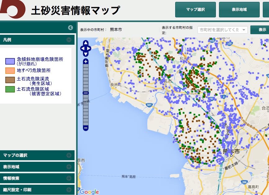
I just came across this map, which provides detailed visual information about areas that are at risk for landslides. This information doesn't change; it merely shows the locations of areas that are deemed to be at risk because of their physical characteristics. This is something that you might refer to if you are considering driving at night, during heavy rain, and are wondering if the area you are driving through might be risky.
http://sabo.kiken.pref.kumamoto.jp/website/sabo/kasho/
There are four colors:
- Blue: Areas with steep inclines (nearly cliffs) that are susceptible to landslides (gakekuzure);
- Orange: Areas that are not as steep as the blue areas but, nonetheless, are susceptible to mudslides and landslides (jisuberi);
- Brown: Gorges along which a mudslide might flow (dosekiryu);
- Green: Areas into which a mudslide flow (from a brown area) might wind up (dosekiryu higai sotei)
When in doubt, err on the side of safety!
-- Kirk