Posts
This news is not specific to Kumamoto but I suspect there are quite a few people here who will be pleased by the change.
http://newsonjapan.com/html/newsdesk/article/110076.php
SIM locks on handsets to be removed in Japan next summer
The Japanese communications ministry is in the final preparations to urge mobile carriers to remove subscriber identity module locks from mobile phones in the summer 2015, a step to allow users to choose their own service providers, sources said Tuesday.

"In spite of its location in the midst of downtown Kumamoto, 'Shinmachi-Furumachi area' preserves old streets and historic atmosphere.
It is a castle town developed around 400 years ago by Kiyomasa KATO, along with his construction project of Kumamoto Castle.
Take a look at the charms of the popular 'experiential tours' and 'walking tours' in Shinmachi-Furumachi area. http://youtu.be/8KTNPJSgpTw"
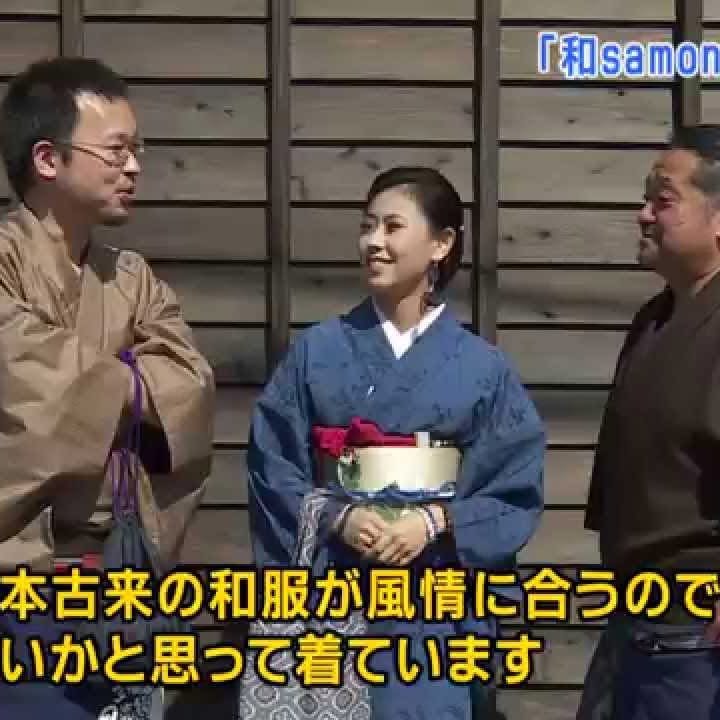
城下町サプライズ ~新町・古町を愛する「和samonもてなし隊」~ Castle Town Surprise
熊本市の中心地にありながら、古い町並みが残る「新町・古町エリア」。 約400年前に、加藤清正が熊本城の築城とともに整備した城下町です。 そんな新町・古町で人気の「体験」や「まちめぐり」の魅力をご紹介します。 Castle Town Surprise - 'Wasamon Motenashi Tai', who l...
An exhibition of works by Jules Pascin is underway at the Prefectural Art Museum. For more information in Japanese and to view more images of Pascin's work, go to the following link:
http://www.museum.pref.kumamoto.jp/event_cal/pub/Detail.aspx?c_id=10&id=42&type=top&trk_kbn=N

The career of Yoshihito KAWAMURA, Director of Kumamoto University's Magnesium Research Center, is discussed on this program.
http://the-japan-news.com/news/article/0001672982
TV documentary ‘Yume no Tobira +’ visits dreamers from past episodes - The Japan News
Ever wondered what happened to the people on “Yume no Tobira +,” the TV documentary series featuring various Japanese technologies and ideas and the people behind them? You’re in luck — that’s just what the show will feature in an upcoming special edition commemorating its 10th anniversary.

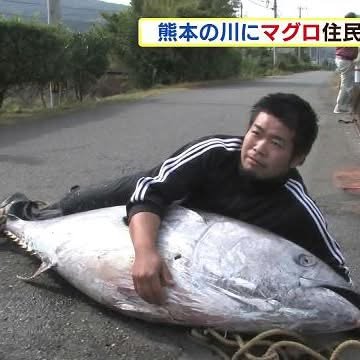
A tuna was found in a river in Kumamoto -- an unusual event. If you click on the link you can see a video about this (in Japanese).
http://news.tv-asahi.co.jp/news_society/articles/000037753.html
熊本県の川でマグロが発見されました。 第一発見者:「向こうから車で帰ってきている途中に黒い物体があったので、近くに行ってみたらマグロだった」 29日午前8時ごろ、熊本県天草市の大宮字川で、マグロが泳いでいるのを近くの住民が見つけました。マグロは引き上げた際、すでに死んでいて、体長が180cm、重さは100kg以上でした。川でマグロが見つかるのは珍しく、エサを追い掛けて迷い込んだとみられます。
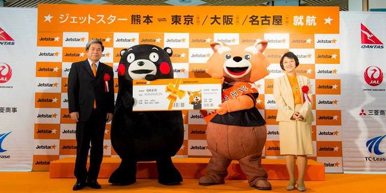
Click on the following link to read an article about Jetstar Japan's start in Kumamoto:
http://www.anna.aero/2014/10/29/jetstar-japan-adds-kumamoto-network/
Kumamoto is presented as a positive model in this article:
"Even then, Kumamoto, a prefecture in Japan, has been successful in reducing the number of killings substantially. Kumamoto, back in 2003, killed 1,200 dogs and cats, but succeeded in reducing this to mere 13 in 2013, due to a specific action taken. Kumamoto was one among many prefectures killing large number of animals back in 2001. And when Mr. Fuchibe, who just had been promoted to Chief Director of Kumamoto Animal Care Center asked each and every worker there about their thoughts towards killing animals, they all answered that they didn’t want to kill any more animals. So, Fuchibe began action, first holding a conference with the Veterinary Medical Association, the Humane Society, and various personnel from the pet field. Things didn’t go easy first, but they all had the same goal — to abolish the killing. Eventually, they were able to reduce the number of animals destroyed to 13 in 2013."
http://www.japanupdate.com/2014/10/our-aim-for-2020-no-stray-slaughter-in-okinawa/
Our aim for 2020 – No stray slaughter in Okinawa
As we had informed you in a previous column, there were a total of 6,604 unclaimed animals (2,501 dogs, 4,103 cats) put to death during the year 2012 in Okinawa

Hi! We recently passed the "900 Likes" milestone. Thanks! If you know someone who you think might be interested in the kind of information we've been posting here, please tell them about the page. One easy way to do that is use the "Share" button at the top of the page.
Also, please check out the mailing list:
https://groups.yahoo.com/neo/groups/kumamoto-i/conversations/messages
Thanks again!

Here's an announcement about a Halloween party:
------ start quote ------
What are u doin this Halloween? Every adult is welcome 2 attend at Barcelona Bar's Halloween Costume Party.Come dressed to impressed in your best costume for a chance 2win cash prizes
One(1) BEST OVERALL ¥15,000+gifts
Two(2) MOST ORIGINAL ¥10,000 each +gifts
Three(3) BEST SCARIEST¥5000 each +gifts
Complete w/OPEN BAR at 8pm,light snack food & games 4all 2enjoy!!!
Ticket pricing:
¥2000 for students(present your school DepEd ID to avail such)
¥2500 in advance
¥3000 at the door
Due 2limited sitting it's strongly recomended that u purchase tickets in advance 2avoid possible disappointments.
If i can be of any assistance in inquiries about this pls. call 080-2748-2874 (anytime). Thank you
----- end quote -------
See
https://groups.yahoo.com/neo/groups/kumamoto-i/conversations/messages/13032
and
https://groups.yahoo.com/neo/groups/kumamoto-i/conversations/messages/13036
The second message says you need to hurry if you want to participate.

I found some information recently about a man on Japan's death row who is said to have impaired cognitive abilities because of congenital Minamata disease.
"Matsumoto Kenji has been on death row for murder since 1993 and could face execution any moment – he has a mental disability as a result of mercury poisoning (Minamata disease), is reportedly paranoid and incoherent as a result of a mental illness he developed during his detention on death row, and his lawyers are seeking a retrial. "
http://www.geocities.jp/hyouhakudanna/punish2000.html#kmatumoto
"松本被告は胎児性水俣病からくる知的障害であり、幼少期から兄に絶対服従だった。県警は、知的障害につけ込んで「男なら自殺した兄の責任も取るべきだ」とそそのかして自白調書を取った。"
In regard to the death penalty, there is one more important connection to Kumamoto. The first man in Japan to be found innocent after first having been sentenced to death for murder was Menda Sakae, a man from what is now Asagiri-machi, near Hitoyoshi:
http://en.wikipedia.org/wiki/Sakae_Menda
http://www.amnestyusa.org/news/news-item/death-penalty-countries-continue-to-execute-people-with-mental-and-intellectual-disabilities
Death Penalty: Countries continue to execute people with mental and intellectual disabilities
Countries around the world continue to sentence to death or to execute people with mental and intellectual disabilities, in clear violation of international standards.

This is one of Kumamoto's "must see" places.
http://the-japan-news.com/news/article/0001644332
Stone culture in Kumamoto Prefecture Aqueduct bridges a symbol of local people’s power - The...
YAMATO, Kumamoto — Horse sashimi, shochu spirits and the mascot character Kumamon are aspects of Kumamoto Prefecture that quickly come to mind for many people. But I’m most impressed with the prefecture’s amazing stone bridges. I recently flew there for a closer look.
"Ne-Net, meanwhile, produced a show that paid special homage to Japanese tradition and spirituality. Models wore geta sandals, which they politely removed before stepping onto a specially designed polka-dot tatami runway (tatami is the famous local good of designer Kazuaki Takashima’s hometown, Yatsushiro, in Kumamoto Prefecture)."
For more information about Kazuaki Takashima and Ne-Net, see
http://ne-net.net/profile/index.html
http://www.japantimes.co.jp/life/2014/10/25/style/mercedes-benz-fashion-week-tokyo-packing-punch/#.VEyATYeyu0w
Mercedes-Benz Fashion Week Tokyo: packing a punch
The womenswear showcased during Mercedes-Benz Fashion Week Tokyo marched to its own beat, with eye-opening collections coming from far-flung ends of the fashion spectrum. From stark minimalism to '80s idols, ...

I wrote about this issue the other day. My message was about how a major eruption of Mt Aso might spread volcanic ash over a very wide area:
https://www.facebook.com/Kumamotoi/posts/719982528075182
This article presents an even scarier perspective on the same report from experts a Kobe University.
http://blogs.wsj.com/japanrealtime/2014/10/23/major-volcanic-eruption-could-make-japan-extinct-study-warns/
Major Volcanic Eruption Could Make Japan ‘Extinct,’ Study Warns
One major volcanic eruption could make Japan "extinct," a study by experts at Kobe University warns, although the chances of that happening are relatively slim.
The Sixth session of the Intergovernmental Negotiating Committee on Mercury (INC 6) will "prepare for the entry into force of the Minamata Convention on Mercury and also address issues that will be decided upon by the Conference of Parties at its first meeting." The convention was adopted here in Kumamoto a little over a year ago. For more information see
http://www.mercuryconvention.org
http://www.iisd.ca/mercury/inc6/
IISD RS @ INC 6 | 3-7 November 2014 | Bangkok, Thailand | IISD Reporting Services
IISD Reporting Services, through its Earth Negotiations Bulletin (ENB), will cover the Sixth session of the Intergovernmental Negotiating Committee on Mercury (INC 6), from 3-7 November 2014, from the UN Economic and Social Commission (ESCAP), Bangkok, Thailand
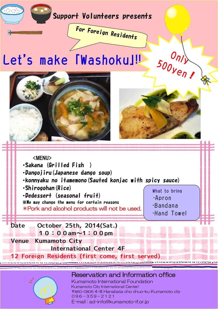
Sorry for the last-minute notice, but I just found this information. For more, see . . .
https://groups.google.com/forum/#!msg/kumamoto-jet/GMhqvZIR5ig/TxKCAExyqTwJ
According to the article, "Kumamoto Wagyu, for example, comes from the rare Japanese brown breed and is a good choice for those seeking a leaner cut."
"Wagyu" (和牛) is literally "Japanese beef."
http://edition.cnn.com/2014/10/07/travel/cnngo-japan-beef-wagyu/index.html?eref=edition

NHK's 7 PM news program featured a story about the possibility of a devastating volcanic eruption in the next 100 years. The report was based on a press conference given by some researchers at Kobe University. The "worst-case scenario" was an eruption of Mt. Aso on a scale that produced the caldera (the valley) tourists go to the area to view. According to that scenario, pyroclastic flows would cover much of Kyushu and up to about 50 centimeters of volcanic ash would cover an area extending to Kobe.
The researchers seem to be arguing that there is a 1% possibility that such an event (though not necessarily in Kyushu) could occur in Japan in the next 100 years and that there is a need to do more research on the prediction of such events and what steps might be taken to limit the extent of the damage.
http://www3.nhk.or.jp/news/html/20141022/k10015614021000.html
巨大噴火 “今後100年間で確率約1%” NHKニュース
日本の広い範囲が火山灰で覆われ、火砕流が100キロ余り先まで達するような巨大噴火が、今後100年間に起きる確率はおよそ1%だとする研究結果を…
As the article indicates, a decision made in Kumamoto in 2001 was a major turning point in Japan's treatment of persons with who have been cured of the disease-causing bacteria (and therefore are not contagious) but may still have health problems stemming from their period of infection.
http://www.japantimes.co.jp/news/2014/10/18/national/crime-legal/supreme-court-probing-validity-of-closed-door-trials-for-leprosy-patients/#.VEYzkL6yu0w
Supreme Court probing validity of closed-door trials for leprosy patients
The Supreme Court has begun to examine the legitimacy of the former practice of trying criminal defendants afflicted with leprosy outside the courts, usually at state-run sanatoriums or detention centers, ...
There will be a little festival in Nishikigaoka Park (Koen) on Oct 26th (see map). The Kumamoto Castle Omotenashi Bushotai (in you are unfamiliar with them see, http://www.manyou-kumamoto.jp/en/plan-your-visit/bushotai.html) will be there at 10:00 AM and Kumamon will be there at 11:40.
https://goo.gl/maps/nnQo8
〒862-0912 Kumamoto-ken, Kumamoto-shi, Higashi-ku, Nishikigaoka, 8 錦ヶ丘公園防災倉庫
